BFD-Mapping

From the Field

Data-driven perspectives on flood risk, drainage infrastructure, and community resilience in East Texas.

Drone mapping tablet identifying standing water alongside stagnant floodwater

When the Water Doesn't Leave: The Growing Health Risk East Texas Communities Can Get Ahead Of

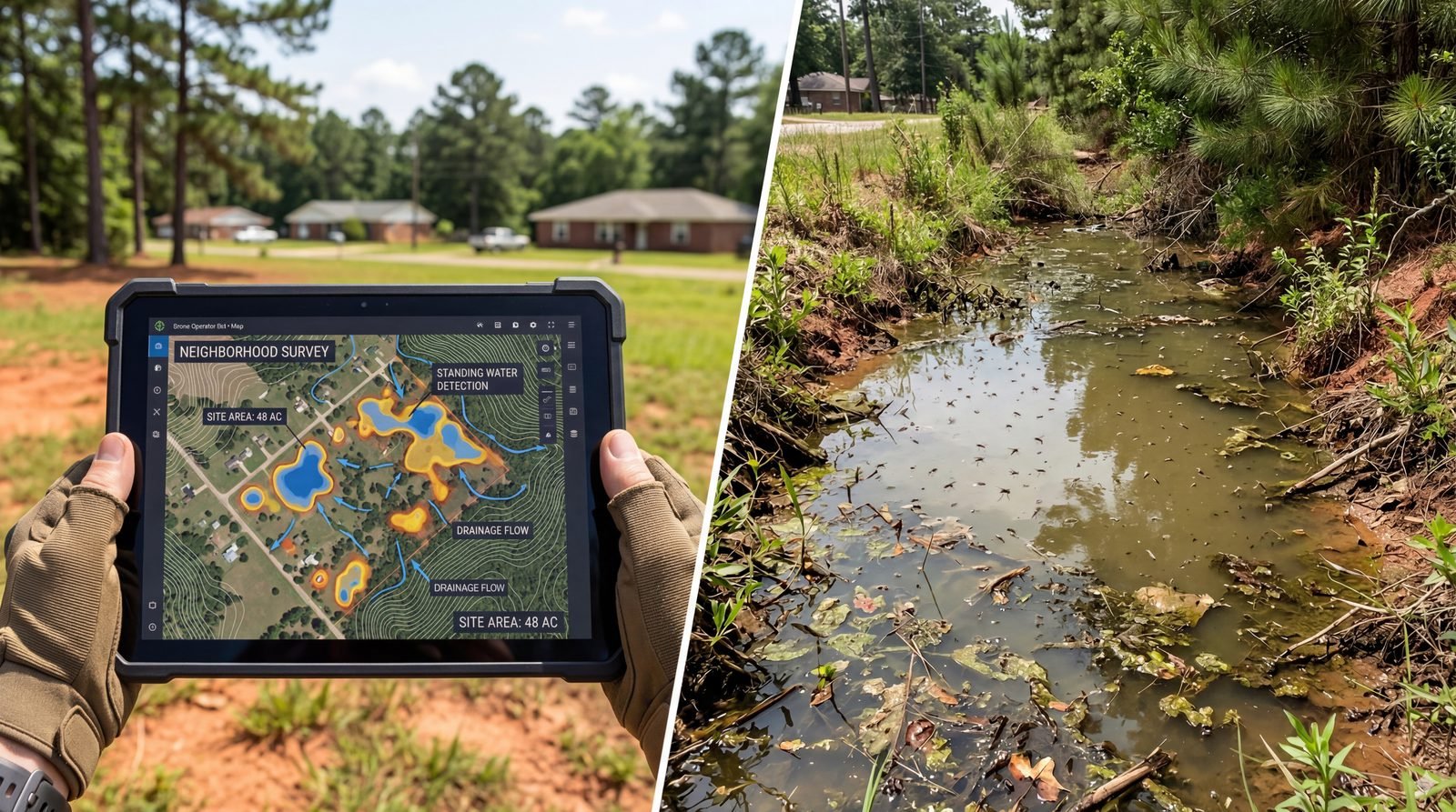
Heavier rains are creating more standing water than reactive mosquito programs can handle. The solution starts with understanding where the water sits — and why.

Texas recorded 455 West Nile virus cases and 56 deaths in 2024 alone. Heartworm prevalence in untreated dogs exceeds 40% in parts of the state. As rainfall intensity increases, the volume of standing water is outpacing what reactive mosquito programs can control. The smarter approach: treat the cause, not just the symptom.

Read full post →

Infrastructure Built for Yesterday's Weather

26 years of NWS data show a pattern shift that every Cedar Creek Lake community should understand.

Extreme rainfall events in Northeast Texas have nearly doubled in frequency since 2013. Communities around Cedar Creek Lake operate drainage infrastructure sized for the 1970s, '80s, and '90s. Updated NOAA Atlas 14 analysis shows historical "100-year" storm depths now recur at "25-year" intervals. The storms aren't waiting.

Read full post →

Stay Informed

Get data-driven insights on flood risk and community resilience delivered to your inbox.

Subscribe on Substack